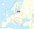
Failu:Latvia in Europe (-rivers -mini map).svg

Failu eyi atata (SVG file, nominally 1,401 × 1,198 pixels, file size: 955 KB)
Failu yi ìnan̄a me Wikimedia Commons, môkọt ire si ibe ke ofifi porojet mêkisa ọmọ irọ inu. Ikpakpa iwele kan̄ me akpọk mkpa-mwele eyi failu kan̄ ke ejeen̄ yi me irak.
Nkana-ngwook
Inyinyi unye
- Owu môkọt:
- icheche ikana – ichichibi, ichon mè iria inu yi isibi
- igwugwugwa – inwenwene ubọk-ikwaan̄ yi itap me ike oweekbe
- Mè ire ochieek irọrọ ikechi:
- itọn̄ yi – Owu òkaan̄ inyinyi itọn̄ ògbegbe, inyi ugọbọ òkisi lek license ya, mè itumu si mè ìre mînwene inu geege. Owu môkọt irọ ikeya me oniin̄ geelek òsisibi inu, ire, karọ me oniin̄ òborọ ibe ebi ene ekekeek ebe ke ogwukaan̄ îrọ owu inye mè ìyaka ire ke îrọ inu owu osabe irọ inye.
- che ikeya si – Ire okpọk igwugwa, inwene, mè ìre inen̄e inu yi isa irọ ofifi inu, owu òkaan̄ icheche inu ya orọbe igọọk me [[ccorg:share-your-work/licensing

|
I'd greatly appreciate, that you attribute this media file to Wikimedia Commons, if used outside Wikipedia or Commons. For use in publications such as books, newspapers, blogs, websites, please insert here the following line:
বাংলা ∙ Deutsch ∙ Deutsch (Sie-Form) ∙ Ελληνικά ∙ English ∙ español ∙ français ∙ Ἀρχαία ἑλληνικὴ ∙ Bahasa Indonesia ∙ 日本語 ∙ македонски ∙ Nederlands ∙ português ∙ русский ∙ Türkçe ∙ 简体中文 ∙ 繁體中文 ∙ +/− |
Captions
Items portrayed in this file
depicts English
creator English
some value
copyright status English
copyrighted English
copyright license English
source of file English
original creation by uploader English
inception English
17 Mâchi 2011
Mfufuk failu
Keme me lek usen-onyan̄/mgbọ inyi òmun̄ failu ike îkupbe me mgbọ ya.
| Usen-oyan̄/Mgbọ | Asabọn-ogugo | Okike | Òsikwaan̄ | Tumu ikọ folek | |
|---|---|---|---|---|---|
| eyi mgbọ keyi | 05:52, 12 Julai 2016 |  | 1,401 × 1,198 (955 KB) | Stasyan117 | Dotted line between Ukraine and Crimea |
| 19:34, 17 Mâchi 2011 |  | 1,401 × 1,198 (1.38 MB) | TUBS |
Ikwaan̄ failu osibe
The following page uses this file:
Inu esabe failu irọ me otutuuk ere
Wiki kechi ekisa failu yi irọ inu:
- Inu esabe irọ me incubator.wikimedia.org
- Inu esabe irọ me zh-yue.wikipedia.org
nkikek etip
Failu yi îkaan̄ etip me lek echi môkọtbe ire ìnan̄a me lek òmọnọ-ogugo mè ìre òmọnọ-iman̄ esabe irom mè ìre esabe inwene ọmọ itap me nkwa-etip.
Ire mînwene failu ya me ebon ere înan̄abe, usini etip ìkup me lek eyi atata kan̄ ya ìkpoje ìkike mèlek eyi mgbọ keyi.
| Width | 1401.34px |
|---|---|
| Height | 1198.34px |


