Failu:Africa-countries-eastern.png
Kpunu eyi òsisiik nkwa igak eyi.
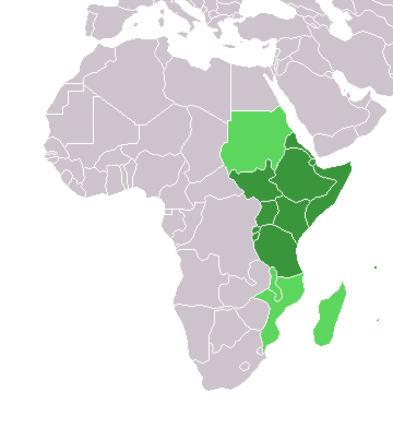
Africa-countries-eastern.png (360 × 392 pixels, file size: 10 KB, MIME type: image/png)

|
File:Africa-countries-eastern.svg is a vector version of this file. It should be used in place of this PNG file when not inferior.
File:Africa-countries-eastern.png → File:Africa-countries-eastern.svg
For more information, see Help:SVG. |
 |
from en:Image:Africa-countries-eastern.png
This map was originally made by w:en:User:Joy on 01:28, 28 March 2004 who created it from the blank maps.

|
Mînyi unye ichichibi, icheche mè/mè ìre inwenwene ekwu yi igọọk me lek nchieek GNU Free Documentation License, Òsolek 1.2 mè ìre eyi mgburudun̄ eyi Free Software Foundation egonbe; with no Invariant Sections, kpunu inu-nge eyi Isi ikpa, kpunu inu-nge eyi udun̄ ikpa. Mîtap copy of license yi me agan̄ ekigwen GNU Free Documentation License. |
| Unye-ngon eyi failu yi ìre eyi Creative Commons Attribution-Share Alike 3.0 Unported license. | ||
| ||
| This licensing tag was added to this file as part of the GFDL licensing update. |
Mfufuk failu
Keme me lek usen-onyan̄/mgbọ inyi òmun̄ failu ike îkupbe me mgbọ ya.
| Usen-oyan̄/Mgbọ | Asabọn-ogugo | Okike | Òsikwaan̄ | Tumu ikọ folek | |
|---|---|---|---|---|---|
| eyi mgbọ keyi | 19:08, 17 Mâchi 2018 | | 360 × 392 (10 KB) | Maphobbyist | Upload |
| 17:42, 13 Jenuwari 2014 |  | 360 × 392 (10 KB) | VVVF | See http://unstats.un.org/unsd/methods/m49/m49regin.htm | |
| 16:18, 13 Jenuwari 2014 |  | 360 × 392 (10 KB) | VVVF | See http://unstats.un.org/unsd/methods/m49/m49regin.htm | |
| 17:06, 9 Julai 2011 |  | 360 × 392 (13 KB) | Maphobbyist | South Sudan has become independent on July 9, 2011. Sudan and South Sudan are shown with the new international border between them. | |
| 21:34, 31 Mâchi 2011 |  | 360 × 392 (13 KB) | Hoshie | added Cabinda (Angola) and Montenengro to the map. | |
| 11:12, 5 Mêe 2006 |  | 360 × 392 (4 KB) | Hautala | optimized with png | |
| 18:28, 29 Epuren 2005 |  | 360 × 392 (13 KB) | ChongDae | from en:Image:Africa-countries-eastern.png {{GFDL}} Category:Map of Africa |
Ikwaan̄ failu osibe
The following page uses this file:
Inu esabe failu irọ me otutuuk ere
Wiki kechi ekisa failu yi irọ inu:
- Inu esabe irọ me af.wikipedia.org
- Inu esabe irọ me ar.wikipedia.org
- Inu esabe irọ me azb.wikipedia.org
- Inu esabe irọ me az.wikipedia.org
- Inu esabe irọ me bg.wikipedia.org
- Inu esabe irọ me bm.wikipedia.org
- Inu esabe irọ me br.wikipedia.org
- Inu esabe irọ me cs.wikipedia.org
- Inu esabe irọ me cv.wikipedia.org
- Inu esabe irọ me en.wikipedia.org
- Inu esabe irọ me es.wikipedia.org
- Inu esabe irọ me eu.wikipedia.org
- Inu esabe irọ me fr.wikipedia.org
- Inu esabe irọ me he.wikipedia.org
- Inu esabe irọ me hy.wikipedia.org
- Inu esabe irọ me id.wikipedia.org
- Inu esabe irọ me incubator.wikimedia.org
- Inu esabe irọ me is.wikipedia.org
- Inu esabe irọ me it.wikipedia.org
- Inu esabe irọ me jv.wikipedia.org
- Inu esabe irọ me kaa.wikipedia.org
Kpọ ebi kè ofifi inu esabe failu yi irọ.